
Carte topographique Barcelonnette
Carte interactive
Cliquez sur la carte pour afficher l’altitude.
Barcelonnette
Barcelonnette est une commune de montagne, entièrement située à plus de 1 100 m d'altitude. Elle est la plus grande commune de la vallée de l'Ubaye, dont elle forme le centre administratif, commercial et urbain.
À propos de cette carte
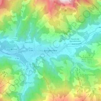
Nom : Carte topographique Barcelonnette, altitude, relief.
Altitude moyenne : 1 494 m
Altitude minimum : 1 103 m
Altitude maximum : 2 479 m