
Carte topographique Saint-Apollinaire
Carte interactive
Cliquez sur la carte pour afficher l’altitude.
À propos de cette carte
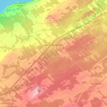
Nom : Carte topographique Saint-Apollinaire, altitude, relief.
Altitude moyenne : 110 m
Altitude minimum : 0 m
Altitude maximum : 179 m
Autres cartes topographiques
Cliquez sur une carte pour visualiser sa topographie, son altitude et son relief.
Saint-Agapit
Canada > Québec > Lotbinière (MRC)
Saint-Agapit, Lotbinière (MRC), Chaudière-Appalaches, Québec, G0S 1Z0, Canada
Altitude moyenne : 130 m
Saint-Narcisse-de-Beaurivage
Canada > Québec > Lotbinière (MRC)
Saint-Narcisse-de-Beaurivage, Lotbinière (MRC), Chaudière-Appalaches, Québec, G0S 1W0, Canada
Altitude moyenne : 156 m
Lotbinière
Canada > Québec > Lotbinière (MRC)
Lotbinière, Lotbinière (MRC), Chaudière-Appalaches, Québec, Canada
Altitude moyenne : 38 m