
Carte topographique Zermatt
Carte interactive
Cliquez sur la carte pour afficher l’altitude.
Zermatt
Zermatt (anciennement en français Praborgne) est une commune suisse du canton du Valais, située dans le district de Viège. Il s'agit de l'une des stations de ski les plus réputées de Suisse et d'Europe, notamment en raison de l'altitude et de l'étendue de son domaine skiable, le plus haut d'Europe et l'un des plus grands d'Europe, et de sa contiguïté avec plusieurs des plus hauts sommets d'Europe, notamment le Cervin (Matterhorn), le Liskamm, la pointe Dufour, la dent Blanche et le Weisshorn.
À propos de cette carte
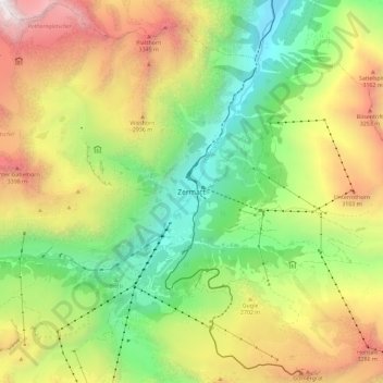
Nom : Carte topographique Zermatt, altitude, relief.
Lieu : Zermatt, Viège, Valais, 3920, Suisse (45.98121 7.70925 46.06121 7.78925)
Altitude moyenne : 2 469 m
Altitude minimum : 1 443 m
Altitude maximum : 3 894 m