Géolocaliser

Carte topographique Valdivia

Carte interactive

Cliquez sur la carte pour afficher l’altitude.

À propos de cette carte

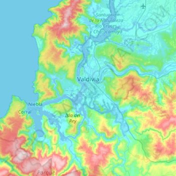
Nom : Carte topographique Valdivia, altitude, relief.

Lieu : Valdivia, Provincia de Valdivia, Los Ríos Region, Chile (-40.03202 -73.41394 -39.63708 -72.92085)

Altitude moyenne : 143 m

Altitude minimum : -3 m

Altitude maximum : 705 m

Within the context of plate tectonics the city lies at a convergent margin where Nazca Plate in the Pacific is subducted beneath the South American Plate. Topographically Valdivia lies in a depression amidst the Chilean Coast Range. The basement rocks that crops out in the hills around the city are of metamorphic type. The city itself is chiefly built upon terraces made up of hardened volcanic sand. This volcanic sandstone is known as "cancagua" and deposited during the late Pleistocene epoch. As terraces took shape during the interglacial preceding the Llanquihue glaciation —the last glacial period— this interglacial is known in Chile as the Valdivia interglacial.

Wikipedia (CC-BY-SA 3.0)

Autres cartes topographiques

Cliquez sur une carte pour visualiser sa topographie, son altitude et son relief.

Neltume

Chile > Los Ríos Region > Provincia de Valdivia

Neltume, Panguipulli, Provincia de Valdivia, Los Ríos Region, Chile

Altitude moyenne : 658 m

Villa California

Chile > Los Ríos Region > Provincia de Valdivia > Valdivia

Villa California, Valdivia, Provincia de Valdivia, Los Ríos Region, 5100861, Chile

Altitude moyenne : 27 m

Villa Endesa

Chile > Los Ríos Region > Provincia de Valdivia > Valdivia

Villa Endesa, Valdivia, Provincia de Valdivia, Los Ríos Region, 5110244, Chile

Altitude moyenne : 8 m