Géolocaliser

Carte topographique Oymyakon

Carte interactive

Cliquez sur la carte pour afficher l’altitude.

À propos de cette carte
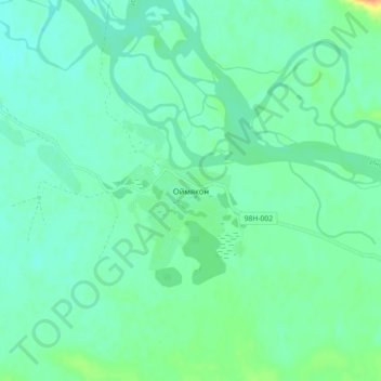
Nom : Carte topographique Oymyakon, altitude, relief.

Lieu : Oymyakon, Борогонский 1-й наслег, Oymyakonsky Ulus, Sakha Republic, Far Eastern Federal District, Russia (63.44295 142.76697 63.48295 142.80697)

Altitude moyenne : 679 m

Altitude minimum : 670 m

Altitude maximum : 704 m

With an extreme subarctic climate (Köppen climate classification Dfd), Oymyakon is known as one of the places considered the Northern Pole of Cold, the other being the town of Verkhoyansk, located 629 km (391 mi) away by air. The weather station is in a valley between Oymyakon and Tomtor. The station is at 750 m (2,460 ft) above sea level and the surrounding mountains, at 1,100 m (3,600 ft), cause cold air to pool in the valley: in fact, recent studies show that winter temperatures in the area increase with altitude by as much as 10 °C (18 °F). The ground is permanently frozen (continuous permafrost).

Wikipedia (CC-BY-SA 3.0)

Autres cartes topographiques

Cliquez sur une carte pour visualiser sa topographie, son altitude et son relief.

Нелькан

Russia > Sakha Republic > Oymyakonsky Ulus

Нелькан, городское поселение Усть-Нера, Oymyakonsky Ulus, Sakha Republic, Far Eastern Federal District, Russia

Altitude moyenne : 1 585 m