
Carte topographique Wałbrzych
Carte interactive
Cliquez sur la carte pour afficher l’altitude.
À propos de cette carte
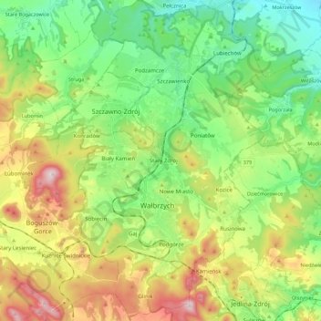
Nom : Carte topographique Wałbrzych, altitude, relief.
Lieu : Wałbrzych, Voïvodie de Basse-Silésie, Pologne (50.71609 16.22718 50.85414 16.35527)
Altitude moyenne : 478 m
Altitude minimum : 275 m
Altitude maximum : 849 m
Autres cartes topographiques
Cliquez sur une carte pour visualiser sa topographie, son altitude et son relief.