
Carte topographique Xochimilco
Carte interactive
Cliquez sur la carte pour afficher l’altitude.
Xochimilco
La partie nord de ce territoire est plane et se situe à l'altitude moyenne de la vallée de Mexico, c'est-à-dire 2 240 m. À cet emplacement se trouvait autrefois le lac de Xochimilco, dont les vestiges sont les canaux de la Chinampería.
À propos de cette carte
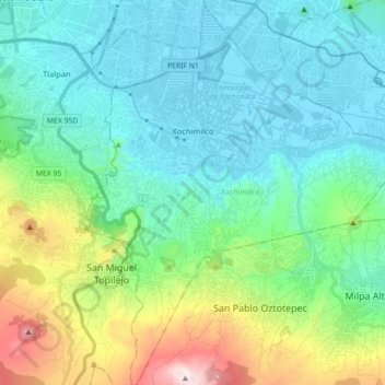
Nom : Carte topographique Xochimilco, altitude, relief.
Lieu : Xochimilco, Mexico, Mexique (19.15254 -99.15439 19.32045 -99.00704)
Altitude moyenne : 2 514 m
Altitude minimum : 2 229 m
Altitude maximum : 3 494 m