
Carte topographique Lowell
Carte interactive
Cliquez sur la carte pour afficher l’altitude.
À propos de cette carte
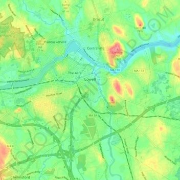
Nom : Carte topographique Lowell, altitude, relief.
Altitude moyenne : 41 m
Altitude minimum : 13 m
Altitude maximum : 90 m
Autres cartes topographiques
Cliquez sur une carte pour visualiser sa topographie, son altitude et son relief.
Baker Bridge
États-Unis d'Amérique > Massachusetts > Middlesex County > Lincoln
Altitude moyenne : 62 m
Marlborough
États-Unis d'Amérique > Massachusetts > Middlesex County > Marlborough
Altitude moyenne : 98 m
Somerville
États-Unis d'Amérique > Massachusetts > Middlesex County > Somerville
Altitude moyenne : 29 m