
Carte topographique Kozaklı İlçe Merkezi
Carte interactive
Cliquez sur la carte pour afficher l’altitude.
À propos de cette carte
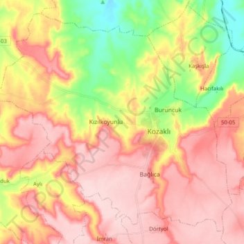
Nom : Carte topographique Kozaklı İlçe Merkezi, altitude, relief.
Altitude moyenne : 1 084 m
Altitude minimum : 963 m
Altitude maximum : 1 170 m
Kozaklı, formerly Hamamorta and Kisla, is a town in Nevşehir Province in the Central Anatolia region of Turkey. It is the seat of Kozaklı District. Its population is 7,589 (2022). Located in Cappadocia, its average elevation is 1,041 m (3,415 ft). Due to its central situation to the nearest larger cities like Nevşehir, Kayseri, Yozgat, Niğde and Kırşehir (within 100 km (62 mi) distance), and particularly due to its natural spas, hamams and hotel facilities, Kozaklı has been a popular resort in Central Anatolia.