
Carte topographique Chittenden County
Carte interactive
Cliquez sur la carte pour afficher l’altitude.
À propos de cette carte
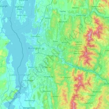
Nom : Carte topographique Chittenden County, altitude, relief.
Lieu : Chittenden County, Vermont, États-Unis d'Amérique (44.16141 -73.36204 44.72281 -72.80238)
Altitude moyenne : 228 m
Altitude minimum : 25 m
Altitude maximum : 1 305 m
Autres cartes topographiques
Cliquez sur une carte pour visualiser sa topographie, son altitude et son relief.