Carte topographique Malolos
Carte interactive
Cliquez sur la carte pour afficher l’altitude.
À propos de cette carte
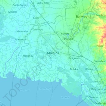
Nom : Carte topographique Malolos, altitude, relief.
Lieu : Malolos, Bulacan, Central Luzon, 3000, Philippines (14.68376 120.65137 15.00376 120.97137)
Altitude moyenne : 6 m
Altitude minimum : -3 m
Altitude maximum : 74 m
Malolos is relatively flat of about 0.81% to a gently sloping of 2.17%. The slope of the land descends towards west, southwest to southern direction. The highest land elevation is at about 6.0 meters above sea level while the lowest is only half a meter below sea level. A network of natural waterways and rivers of various sizes and importance is traversing through the landscape of the town down south to Manila Bay.