
Carte topographique Clows Top
Carte interactive
Cliquez sur la carte pour afficher l’altitude.
À propos de cette carte
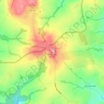
Nom : Carte topographique Clows Top, altitude, relief.
Altitude moyenne : 176 m
Altitude minimum : 118 m
Altitude maximum : 232 m
Autres cartes topographiques
Cliquez sur une carte pour visualiser sa topographie, son altitude et son relief.
Cookley
United Kingdom > England > Worcestershire > Wyre Forest District
Cookley, Wyre Forest District, Worcestershire, England, DY10 3UJ, United Kingdom
Altitude moyenne : 70 m
Foley Park
United Kingdom > England > Worcestershire > Wyre Forest District > Foley Park
Foley Park, Wyre Forest District, Worcestershire, England, DY11 7BE, United Kingdom
Altitude moyenne : 55 m