
Carte topographique Channarayapattana
Carte interactive
Cliquez sur la carte pour afficher l’altitude.
À propos de cette carte
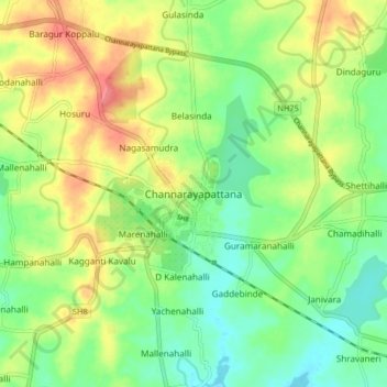
Nom : Carte topographique Channarayapattana, altitude, relief.
Altitude moyenne : 850 m
Altitude minimum : 822 m
Altitude maximum : 889 m
Channarayapatna is in Hassan District in Karnataka state, India and located at 12°54′N 76°23′E / 12.90°N 76.39°E / 12.90; 76.39. It has an average elevation of 845 metres (2716 ft).