
Carte topographique Firstacker
Carte interactive
Cliquez sur la carte pour afficher l’altitude.
À propos de cette carte
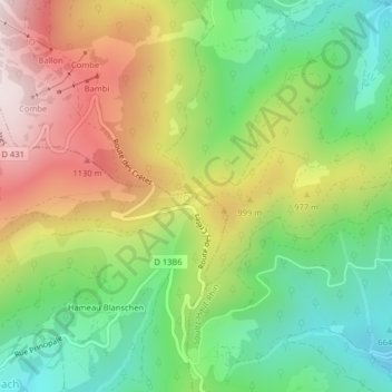
Nom : Carte topographique Firstacker, altitude, relief.
Altitude moyenne : 873 m
Altitude minimum : 600 m
Altitude maximum : 1 236 m
Autres cartes topographiques
Cliquez sur une carte pour visualiser sa topographie, son altitude et son relief.
Vosges
France > Grand Est > Goldbach-Altenbach
Vosges, Goldbach-Altenbach, Thann-Guebwiller, Haut-Rhin, Grand Est, France métropolitaine, 68760, France
Altitude moyenne : 864 m
Col Amic
France > Grand Est > Goldbach-Altenbach
Col Amic, D 13BVI, Goldbach-Altenbach, Thann-Guebwiller, Haut-Rhin, Grand Est, France métropolitaine, 68760, France
Altitude moyenne : 804 m