
Carte topographique Reocín
Carte interactive
Cliquez sur la carte pour afficher l’altitude.
À propos de cette carte
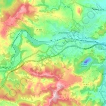
Nom : Carte topographique Reocín, altitude, relief.
Lieu : Reocín, Saja-Nansa, Cantabria, España (43.32132 -4.17500 43.37962 -4.07653)
Altitude moyenne : 128 m
Altitude minimum : -45 m
Altitude maximum : 312 m
Autres cartes topographiques
Cliquez sur une carte pour visualiser sa topographie, son altitude et son relief.
Puente San Miguel
España > Cantabria > Saja-Nansa > Reocín > Puente San Miguel
Puente San Miguel, Reocín, Saja-Nansa, Cantabria, 39530, España
Altitude moyenne : 69 m