
Carte topographique Old Hickory Lake
Carte interactive
Cliquez sur la carte pour afficher l’altitude.
À propos de cette carte
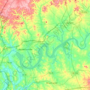
Nom : Carte topographique Old Hickory Lake, altitude, relief.
Altitude moyenne : 171 m
Altitude minimum : 116 m
Altitude maximum : 287 m
Old Hickory Lake is a mainstream storage impoundment on the Cumberland River operated by the U.S. Army Corps of Engineers. The reservoir contains 22,500 acres (91 km2) at an elevation of 445 feet (above sea level) and extends 97.3 river miles. Water level fluctuations are minimal with minimum pool elevation at 442 feet (135 m). Public facilities include eight marinas, two Corps-operated campgrounds, and 41 boat access sites, as well as the Old Hickory Lake Arboretum.