
Carte topographique Big Lake
Carte interactive
Cliquez sur la carte pour afficher l’altitude.
À propos de cette carte
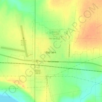
Nom : Carte topographique Big Lake, altitude, relief.
Lieu : Big Lake, Reagan County, Texas, 76932, United States (31.18253 -101.48117 31.20946 -101.42990)
Altitude moyenne : 820 m
Altitude minimum : 798 m
Altitude maximum : 835 m
Big Lake experiences a hot semi-arid climate, typical of west Texas and parts of central Texas. Summers are long and hot, and winters are short and relatively mild. In the summer, low humidity helps temper the heat. Due to Big Lake's aridity and elevation, temperatures drop quickly after sunset, especially in the summer. Some precipitation falls in summer months, mostly as fast moving thunderstorms. Winters are dry. Winter temperatures occasionally drop below freezing at night, but sustained, bitter cold, is uncommon. Snowfall is rare, never exceeds a few inches, and usually melts quickly.