
Carte topographique The Fleet
Carte interactive
Cliquez sur la carte pour afficher l’altitude.
À propos de cette carte
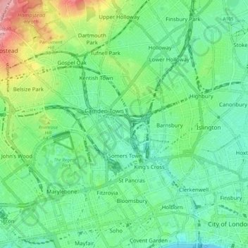
Nom : Carte topographique The Fleet, altitude, relief.
Altitude moyenne : 41 m
Altitude minimum : 2 m
Altitude maximum : 135 m
Autres cartes topographiques
Cliquez sur une carte pour visualiser sa topographie, son altitude et son relief.
City of London
United Kingdom > England > City of London > City of London
City of London, England, EC2V 5AE, United Kingdom
Altitude moyenne : 42 m