
Carte topographique Broomfield
Carte interactive
Cliquez sur la carte pour afficher l’altitude.
À propos de cette carte
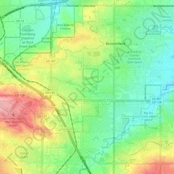
Nom : Carte topographique Broomfield, altitude, relief.
Altitude moyenne : 1 633 m
Altitude minimum : 1 584 m
Altitude maximum : 1 720 m
Autres cartes topographiques
Cliquez sur une carte pour visualiser sa topographie, son altitude et son relief.
Interlocken East Park
United States > Colorado > City and County of Broomfield > Broomfield
Interlocken East Park, Broomfield, City and County of Broomfield, Colorado, 80021, United States
Altitude moyenne : 1 669 m