
Carte topographique Ramona
Carte interactive
Cliquez sur la carte pour afficher l’altitude.
Ramona
On January 2006, Ramona Valley was designated the country's 162nd American Viticultural Area (AVA) by the Alcohol and Tobacco Tax and Trade Bureau, which recognized the area for its distinctive microclimate, elevation, and soil attributes.
À propos de cette carte
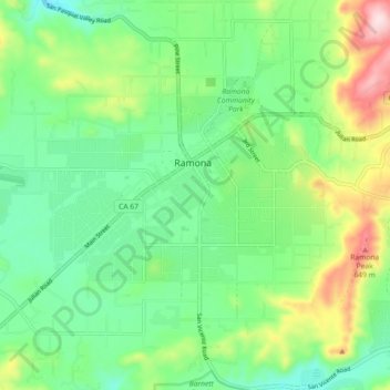
Nom : Carte topographique Ramona, altitude, relief.
Altitude moyenne : 466 m
Altitude minimum : 357 m
Altitude maximum : 701 m