
Carte topographique Dandeli
Carte interactive
Cliquez sur la carte pour afficher l’altitude.
À propos de cette carte
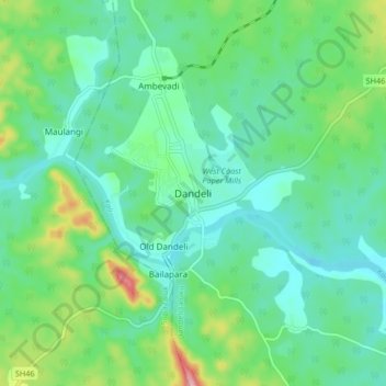
Nom : Carte topographique Dandeli, altitude, relief.
Altitude moyenne : 480 m
Altitude minimum : 433 m
Altitude maximum : 623 m
Dandeli is located at 15.247719N, 74.629678W. It has an average elevation of 473 metres (1,552 ft) and has received heavy rainfall during August to November (see chart below). Because of good forest cover and moderate elevation, the location has a tropical highland climate, averaging about 27 °C (81 °F) in summer and 18 °C (64 °F) in winter.