
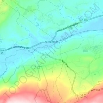
Carte topographique Kerhonkson
Carte interactive
Cliquez sur la carte pour afficher l’altitude.
À propos de cette carte
Nom : Carte topographique Kerhonkson, altitude, relief.
Altitude moyenne : 167 m
Altitude minimum : 70 m
Altitude maximum : 428 m
Autres cartes topographiques
Cliquez sur une carte pour visualiser sa topographie, son altitude et son relief.
Minnewaska State Park Preserve
United States > New York > Ulster County > Town of Wawarsing
Minnewaska State Park Preserve, Town of Wawarsing, Town of Shawangunk, Ulster County, New York, United States
Altitude moyenne : 279 m
Village of Ellenville
United States > New York > Ulster County > Town of Wawarsing
Village of Ellenville, Town of Wawarsing, Ulster County, New York, United States
Altitude moyenne : 325 m
Greenfield Park
United States > New York > Ulster County > Town of Wawarsing
Greenfield Park, Town of Wawarsing, Ulster County, New York, 12435, United States
Altitude moyenne : 331 m