
Carte topographique Rawdon
Carte interactive
Cliquez sur la carte pour afficher l’altitude.
À propos de cette carte
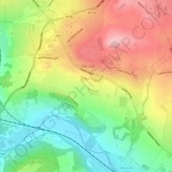
Nom : Carte topographique Rawdon, altitude, relief.
Lieu : Rawdon, Leeds, West Yorkshire, England, United Kingdom (53.83413 -1.70505 53.86007 -1.65634)
Altitude moyenne : 131 m
Altitude minimum : 43 m
Altitude maximum : 232 m
Autres cartes topographiques
Cliquez sur une carte pour visualiser sa topographie, son altitude et son relief.
Rawdon Crematorium
United Kingdom > England > Leeds > Rawdon
Rawdon Crematorium, Rawdon, Leeds, West Yorkshire, Yorkshire and the Humber, England, LS19 6JP, United Kingdom
Altitude moyenne : 120 m