
Carte topographique Kollegal
Carte interactive
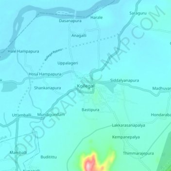
Cliquez sur la carte pour afficher l’altitude.
À propos de cette carte
Nom : Carte topographique Kollegal, altitude, relief.
Altitude moyenne : 645 m
Altitude minimum : 625 m
Altitude maximum : 901 m
Kollegala is located at 12°09′N 77°07′E / 12.15°N 77.12°E / 12.15; 77.12. It has an average elevation of 588 m (1,929 ft). Since the town is on the foothills of the Western Ghats, it is home to a mixed topography. Temperature is moderate.