
Carte topographique Port Angeles
Carte interactive
Cliquez sur la carte pour afficher l’altitude.
À propos de cette carte
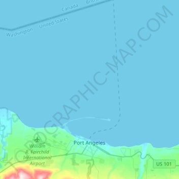
Nom : Carte topographique Port Angeles, altitude, relief.
Altitude moyenne : 27 m
Altitude minimum : -6 m
Altitude maximum : 501 m
Autres cartes topographiques
Cliquez sur une carte pour visualiser sa topographie, son altitude et son relief.
Sequim
United States > Washington > Clallam County
Sequim, Clallam County, Washington, United States
Altitude moyenne : 88 m
Lake Crescent
United States > Washington > Clallam County
Lake Crescent, Clallam County, Washington, United States
Altitude moyenne : 564 m
Solmar Lake Dam
United States > Washington > Clallam County
Solmar Lake Dam, Clallam County, Washington, United States
Altitude moyenne : 80 m
Clallam Bay
United States > Washington > Clallam County
Clallam Bay, Clallam County, Washington, United States
Altitude moyenne : 39 m
Sunrise View Point
United States > Washington > Clallam County
Sunrise View Point, Hurricane Ridge to Switchback Trail, Clallam County, Washington, United States
Altitude moyenne : 1 397 m
Lake Crescent
United States > Washington > Clallam County
Lake Crescent, Clallam County, Washington, United States
Altitude moyenne : 564 m