
Carte topographique Neebing River
Carte interactive
Cliquez sur la carte pour afficher l’altitude.
À propos de cette carte
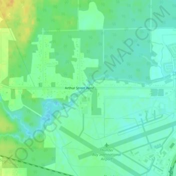
Nom : Carte topographique Neebing River, altitude, relief.
Altitude moyenne : 197 m
Altitude minimum : 187 m
Altitude maximum : 214 m
Autres cartes topographiques
Cliquez sur une carte pour visualiser sa topographie, son altitude et son relief.
Kaministiquia River
Canada > Ontario > Thunder Bay
Kaministiquia River, Thunder Bay, Thunder Bay District, Ontario, P7E 6T9, Canada
Altitude moyenne : 249 m