
Carte topographique Iztapalapa
Carte interactive
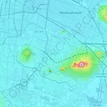
Cliquez sur la carte pour afficher l’altitude.
À propos de cette carte
Nom : Carte topographique Iztapalapa, altitude, relief.
Lieu : Iztapalapa, Mexico City, Mexico (19.28496 -99.14002 19.40074 -98.96045)
Altitude moyenne : 2 248 m
Altitude minimum : 2 221 m
Altitude maximum : 2 632 m
The borough has an average elevation of 2,240 m (7,350 ft) asl and extends over firm land and what was former lake bed of Lake Texcoco. Some of the firm land is alluvial plain but most of it are elevations such as the Cerro de la Estrella (2,460 m or 8,070 ft asl), Peñón Viejo or Peñon del Marqués (2,400 m or 7,900 ft asl), and the Sierra de Santa Catalina, which contains the Cerro Tecuatzi (2,640 m or 8,660 ft asl), Cerro Tetecón (2,480 m or 8,140 ft asl), and the Guadalupe Borrego (2,820 m or 9,250 ft asl), Xaltepec (2,500 m or 8,200 ft asl); and Yuhualixqui (2,420 m or 7,940 ft asl) volcanoes. These are recent geological formations, with evidence of lava flow still existent and none extend over 1,000 meters (3,300 ft) above the valley floor. Culturally, the most important of these elevations is the Cerro de la Estrella, which was the site of the New Fire ceremony. Since the pre-Hispanic period, Lake Texcoco has been drained, leaving behind only two natural river called the Churubusco and La Piedad, which unite to form the Unido River, and a few canals. However, the rivers are confined to large pipes as is one of the canals, and most of the Canal Nacional which forms part of the border of the borough has been filled in to create Calzada La Viga road. For this reason, there are no longer any naturally occurring surface water.
Autres cartes topographiques
Cliquez sur une carte pour visualiser sa topographie, son altitude et son relief.
Parque España
Parque España, Condesa, Cuauhtémoc, Mexico City, 06140, Mexico
Altitude moyenne : 2 242 m
Island of the Dead Dolls
Island of the Dead Dolls, Xochimilco, Mexico City, 16043, Mexico
Altitude moyenne : 2 235 m
Bosque de Chapultepec
Bosque de Chapultepec, Mexico City, 11590, Mexico
Altitude moyenne : 2 296 m