
Carte topographique Gajwel
Carte interactive
Cliquez sur la carte pour afficher l’altitude.
À propos de cette carte
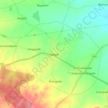
Nom : Carte topographique Gajwel, altitude, relief.
Altitude moyenne : 568 m
Altitude minimum : 532 m
Altitude maximum : 620 m
The town is located on the Deccan Plateau and is surrounded by agricultural lands. It lies at an average elevation of around 540 meters (1,770 feet) above sea level. The area is characterized by undulating terrain with scattered hills and valleys.