
Carte topographique Hiriyur
Carte interactive
Cliquez sur la carte pour afficher l’altitude.
Hiriyur
Hiriyur is located at 13°57′N 76°37′E / 13.95°N 76.62°E / 13.95; 76.62. It has an average elevation of 630 metres (2066 feet). The months of March and April are the hottest months of the year.
À propos de cette carte
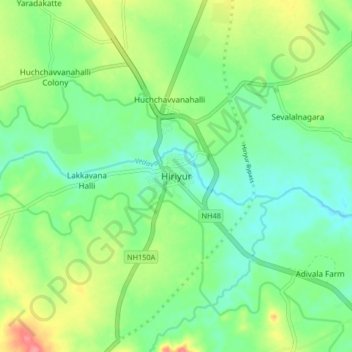
Nom : Carte topographique Hiriyur, altitude, relief.
Lieu : Hiriyur, Hiriyuru taluk, Chitradurga, Karnataka, 572143, India (13.90432 76.57674 13.98432 76.65674)
Altitude moyenne : 613 m
Altitude minimum : 585 m
Altitude maximum : 668 m