
Carte topographique Burt Lake
Carte interactive
Cliquez sur la carte pour afficher l’altitude.
À propos de cette carte
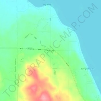
Nom : Carte topographique Burt Lake, altitude, relief.
Altitude moyenne : 207 m
Altitude minimum : 175 m
Altitude maximum : 289 m
Autres cartes topographiques
Cliquez sur une carte pour visualiser sa topographie, son altitude et son relief.
Ellis Township
United States > Michigan > Cheboygan County
Ellis Township, Cheboygan County, Michigan, United States
Altitude moyenne : 253 m
Mentor Township
United States > Michigan > Cheboygan County
Mentor Township, Cheboygan County, Michigan, United States
Altitude moyenne : 258 m