
Carte topographique Fish Lake
Carte interactive
Cliquez sur la carte pour afficher l’altitude.
À propos de cette carte
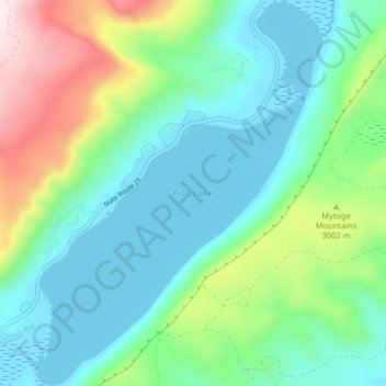
Nom : Carte topographique Fish Lake, altitude, relief.
Lieu : Fish Lake, Sevier County, Utah, United States (38.51973 -111.73857 38.58301 -111.67746)
Altitude moyenne : 2 886 m
Altitude minimum : 2 694 m
Altitude maximum : 3 438 m
Fish Lake is a high alpine lake (elevation approximately 8,848 ft or 2,700 m) located in the Fishlake/ Southern Wasatch Plateau region of south-central Utah, United States. It lies within and is the namesake of the Fishlake National Forest.