
Carte topographique Tinian Island
Carte interactive
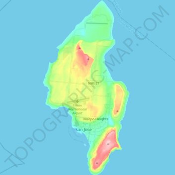
Cliquez sur la carte pour afficher l’altitude.
À propos de cette carte
Nom : Carte topographique Tinian Island, altitude, relief.
Altitude moyenne : 17 m
Altitude minimum : 0 m
Altitude maximum : 187 m
Tinian is about 5 nautical miles (9.3 km) southwest of Saipan, from which it is separated by the Saipan Channel. It has a land area of 39 square miles (100 km2), with its highest elevation at Mount Lasso at 171 meters (561 ft).