
Carte topographique Galeras
Carte interactive
Cliquez sur la carte pour afficher l’altitude.
À propos de cette carte
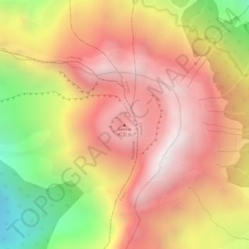
Nom : Carte topographique Galeras, altitude, relief.
Lieu : Galeras, Consacá, Occidente, Nariño, Colombia (1.22148 -77.35901 1.22158 -77.35891)
Altitude moyenne : 3 847 m
Altitude minimum : 3 243 m
Altitude maximum : 4 208 m
Numerous minor tremors and ash emissions since March 2006 culminated on 12 July 2006 in three explosive eruptions, producing an ash and gas column reaching an altitude of 8 kilometres (5.0 mi). Rock falls and pyroclastic flows were reported from towns as distant as Consacá, 11.4 kilometres (7.1 mi) west of the main crater. The Colombian government has repeatedly ordered evacuations to temporary shelters, of more than 8500 people residing in the highest risk areas surrounding the volcano, with hopes of eventual assistance toward permanent relocation.