Carte topographique Bocholt
Cliquez sur la carte pour afficher l’altitude.
Bocholt
The climate in the region of Bocholt and West Münsterland is temperate with distinct maritime influences, with very mild winters in comparison to other German regions because of the proximity to the ocean and the low elevation. Summers are moderately warm. The average temperature in January is 2.7 °C (37 °F) and in July 18.4 °C (65 °F).
À propos de cette carte
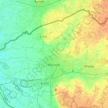
Nom : Carte topographique Bocholt, altitude, relief.
Lieu : Bocholt, Kreis Borken, North Rhine-Westphalia, Germany (51.78982 6.47251 51.91759 6.72119)
Altitude moyenne : 31 m
Altitude minimum : 16 m
Altitude maximum : 60 m
Autres cartes topographiques
Cliquez sur une carte pour visualiser sa topographie, son altitude et son relief.


Isselburg
Germany > North Rhine-Westphalia > Kreis Borken > Isselburg > Isselburg
Altitude moyenne : 19 m