Géolocaliser

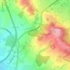
Carte topographique Rubery

Cliquez sur la carte pour afficher l’altitude.

À propos de cette carte
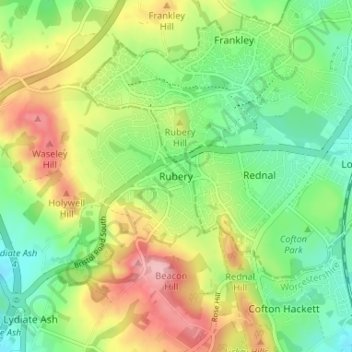
Nom : Carte topographique Rubery, altitude, relief.

Lieu : Rubery, Bromsgrove, Worcestershire, England, B45 9DD, United Kingdom (52.37266 -2.03668 52.41266 -1.99668)

Altitude moyenne : 213 m

Altitude minimum : 155 m

Altitude maximum : 298 m

Autres cartes topographiques

Cliquez sur une carte pour visualiser sa topographie, son altitude et son relief.
Romsley CP

United Kingdom > England > Worcestershire > Bromsgrove

Altitude moyenne : 205 m

Finstall CP

United Kingdom > England > Worcestershire > Bromsgrove

Altitude moyenne : 110 m

Beoley CP

United Kingdom > England > Worcestershire > Bromsgrove > Holt End

Altitude moyenne : 134 m

Clent

United Kingdom > England > Worcestershire > Bromsgrove

Because of the hilly topography of the parish the village consists of several distinct hamlets. These are Upper Clent (Clatterbach and the area around the parish church of St. Leonard), Lower Clent, Holy Cross, Adams Hill and Walton Pool. The Civil Parish of Clent also included part of the village of West…

Altitude moyenne : 184 m
Wythall CP

United Kingdom > England > Worcestershire > Bromsgrove

Altitude moyenne : 155 m

Romsley CP

United Kingdom > England > Worcestershire > Bromsgrove

Altitude moyenne : 205 m

Wythall CP

United Kingdom > England > Worcestershire > Bromsgrove

Altitude moyenne : 155 m

Wythall CP

United Kingdom > England > Worcestershire > Bromsgrove

Altitude moyenne : 155 m

Équipez-vous pour votre prochaine aventure :

🎒Sac à Dos 30 Litres - Volume idéal pour une journée d'exploration topographique
🧰Kits de survie - Équipement essentiel pour situations imprévues
🖼️Carte Topographique - Décoration murale élégante pour les fans de relief
🧗Accessoires de trekking - Compléments indispensables pour la marche
📦Boîtes étanches outdoor - Protection du matériel sensible

En tant que Partenaire Amazon, ce site perçoit une commission sur les achats éligibles sans surcoût pour vous.