
Carte topographique Rădăuți
Carte interactive
Cliquez sur la carte pour afficher l’altitude.
À propos de cette carte
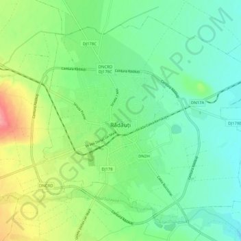
Nom : Carte topographique Rădăuți, altitude, relief.
Lieu : Rădăuți, Suceava, 725400, Romania (47.81762 25.88175 47.87670 25.98307)
Altitude moyenne : 374 m
Altitude minimum : 345 m
Altitude maximum : 435 m
Rădăuți is situated in Bukovina, on a plain between the Suceava and Sucevița rivers, 37 km (23 mi) northwest from Suceava, the county capital. The city is located in the depression with the same name, at 375 metres (410 yards) altitude. It is one of the oldest settlements in Moldavia, known since the 15th century. The towns of Siret, Solca, Milișăuți, and Vicovu de Sus are located relatively close to the city, in the Rădăuți urban area of influence.
Autres cartes topographiques
Cliquez sur une carte pour visualiser sa topographie, son altitude et son relief.