
Carte topographique Cartaxo
Carte interactive
Cliquez sur la carte pour afficher l’altitude.
À propos de cette carte
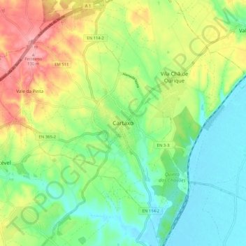
Nom : Carte topographique Cartaxo, altitude, relief.
Altitude moyenne : 50 m
Altitude minimum : 1 m
Altitude maximum : 130 m
In the middle of the 19th century, Cartaxo was one of the more populated areas of Estremadura, in the Comarca of Santarém, with just over 200 inhabitants. On the death of King John IV of Portugal, his testament granted several "honours" to his daughter (in 1656). On 10 December 1815, by royal decree from Rio de Janeiro, King John VI granted it administrative independence, followed up on 21 June 1995 with its elevation to the status of city.