
Carte topographique Port Campbell Coastal Reserve
Carte interactive
Cliquez sur la carte pour afficher l’altitude.
À propos de cette carte
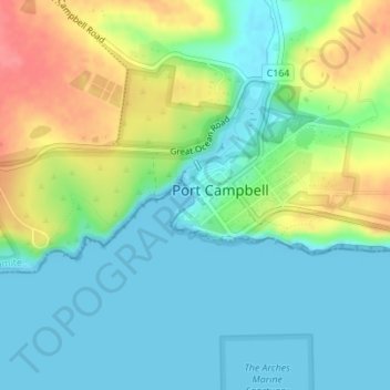
Nom : Carte topographique Port Campbell Coastal Reserve, altitude, relief.
Altitude moyenne : 25 m
Altitude minimum : 0 m
Altitude maximum : 75 m
Autres cartes topographiques
Cliquez sur une carte pour visualiser sa topographie, son altitude et son relief.
Port Campbell
Australia > Victoria > Port Campbell
Port Campbell, Shire of Corangamite, Victoria, 3269, Australia
Altitude moyenne : 38 m