
Carte topographique Stone
Carte interactive
Cliquez sur la carte pour afficher l’altitude.
À propos de cette carte
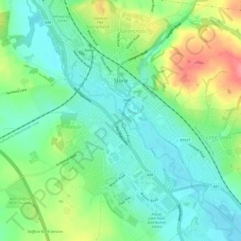
Nom : Carte topographique Stone, altitude, relief.
Lieu : Stone, Staffordshire, West Midlands, England, United Kingdom (52.87949 -2.16587 52.91520 -2.12017)
Altitude moyenne : 107 m
Altitude minimum : 80 m
Altitude maximum : 162 m
Stone lies within the territory of the Iron Age Celtic tribe 'the cornovii' (people of the horn; perhaps a horned god or topographical feature) mentioned by Ptolemy 2nd century AD in Geographia. To the northwest of Stone lies one of their hill forts which overlooks the Trent and perhaps the salt production in the region.