
Carte topographique Stormont, Dundas and Glengarry
Carte interactive
Cliquez sur la carte pour afficher l’altitude.
À propos de cette carte
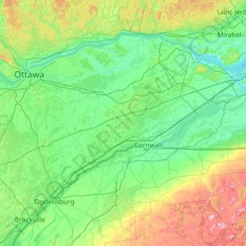
Nom : Carte topographique Stormont, Dundas and Glengarry, altitude, relief.
Altitude moyenne : 153 m
Altitude minimum : 19 m
Altitude maximum : 974 m
Autres cartes topographiques
Cliquez sur une carte pour visualiser sa topographie, son altitude et son relief.
Lac Saint-François
Canada > Ontario > Stormont, Dundas and Glengarry Counties > South Glengarry
Altitude moyenne : 116 m