
Carte topographique Oneida County
Carte interactive
Cliquez sur la carte pour afficher l’altitude.
À propos de cette carte
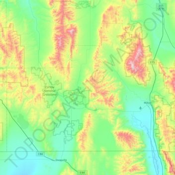
Nom : Carte topographique Oneida County, altitude, relief.
Lieu : Oneida County, Idaho, United States (41.99724 -113.00008 42.50306 -112.07027)
Altitude moyenne : 1 678 m
Altitude minimum : 1 325 m
Altitude maximum : 2 747 m
Oxford Peak is the highest point in the county at 9,285 ft (2830.2 m) above sea level. Alternating valleys and ridges of mountains or hills typify the topography, with grassland and sagebrush covering most areas. The Curlew National Grassland lies within the county.