
Carte topographique Kanaal van St. Andries
Carte interactive
Cliquez sur la carte pour afficher l’altitude.
À propos de cette carte
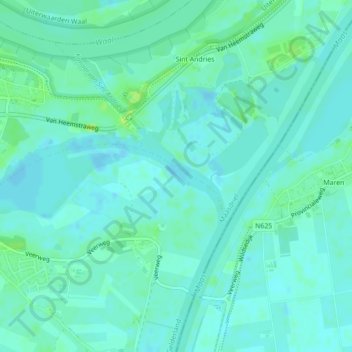
Nom : Carte topographique Kanaal van St. Andries, altitude, relief.
Altitude moyenne : 4 m
Altitude minimum : -1 m
Altitude maximum : 13 m
Autres cartes topographiques
Cliquez sur une carte pour visualiser sa topographie, son altitude et son relief.
Velddriel
Nederland > Gelderland > Maasdriel
Velddriel, Maasdriel, Gelderland, Nederland
Altitude moyenne : 3 m