
Carte topographique Sutton
Carte interactive
Cliquez sur la carte pour afficher l’altitude.
Sutton
The highest point in Sutton is the summit of Mount Hor in the northern corner of town, with an elevation of 2,656 feet (809.5 m) above sea level. The modest elevation of this town gives it a slightly cooler and wetter climate than nearby towns such as St. Johnsbury. Annual snowfall averages well over 100 inches per year at the weather station in the center of town.
À propos de cette carte
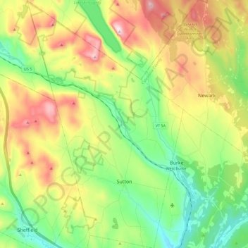
Nom : Carte topographique Sutton, altitude, relief.
Lieu : Sutton, Caledonia County, Vermont, 05867, United States (44.59017 -72.11436 44.74981 -71.97325)
Altitude moyenne : 459 m
Altitude minimum : 224 m
Altitude maximum : 830 m