
Carte topographique Vliet
Carte interactive
Cliquez sur la carte pour afficher l’altitude.
À propos de cette carte
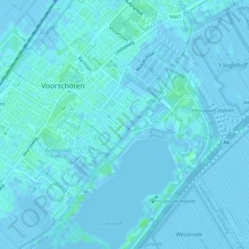
Nom : Carte topographique Vliet, altitude, relief.
Altitude moyenne : 1 m
Altitude minimum : -4 m
Altitude maximum : 6 m
Autres cartes topographiques
Cliquez sur une carte pour visualiser sa topographie, son altitude et son relief.
Wilsveen
Nederland > Zuid-Holland > Leidschendam
Wilsveen, Leidschendam, Leidschendam-Voorburg, Zuid-Holland, Nederland, 2266 LN, Nederland
Altitude moyenne : -3 m
Vliet
Nederland > Zuid-Holland > Leidschendam
Vliet, Leidschendam, Leidschendam-Voorburg, Zuid-Holland, Nederland, 2266 BN, Nederland
Altitude moyenne : 1 m
Stompwijk
Nederland > Zuid-Holland > Leidschendam
Stompwijk, Leidschendam, Leidschendam-Voorburg, Zuid-Holland, Nederland, 2266 HL, Nederland
Altitude moyenne : -3 m