
Carte topographique Mieszków
Carte interactive
Cliquez sur la carte pour afficher l’altitude.
À propos de cette carte
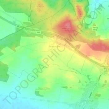
Nom : Carte topographique Mieszków, altitude, relief.
Altitude moyenne : 173 m
Altitude minimum : 139 m
Altitude maximum : 220 m
Autres cartes topographiques
Cliquez sur une carte pour visualiser sa topographie, son altitude et son relief.
Gaworzyce
Poland > Lower Silesian Voivodeship > Polkowice County
Gaworzyce, gmina Gaworzyce, Polkowice County, Lower Silesian Voivodeship, 59-180, Poland
Altitude moyenne : 144 m