
Carte topographique Bellingham
Carte interactive
Cliquez sur la carte pour afficher l’altitude.
À propos de cette carte
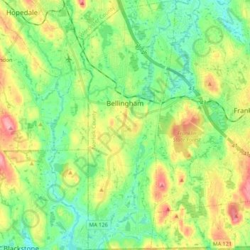
Nom : Carte topographique Bellingham, altitude, relief.
Altitude moyenne : 84 m
Altitude minimum : 45 m
Altitude maximum : 153 m
According to the United States Census Bureau, the town has a total area of 19.0 square miles (49.2 km2), of which 18.5 square miles (47.9 km2) is land and 0.5 square mile (1.3 km2) (2.58%) is water. The town's mean elevation is 293 feet (89 m) above sea level.