
Carte topographique Benito Juárez
Carte interactive
Cliquez sur la carte pour afficher l’altitude.
Benito Juárez
In response to the French invasion and the elevation of Maximilian as Emperor of Mexico, Juárez sent General Plácido Vega y Daza to California to gather Mexican American sympathy for republican Mexico. Maximilian offered Juárez amnesty and later the post of prime minister, but Juárez refused to accept a government "imposed by foreigners," or a monarchy. The US government was sympathetic to Juárez, refusing to recognize Maximilian and opposing the French invasion as a violation of the Monroe Doctrine. Most of its attention was taken up by the American Civil War.
À propos de cette carte
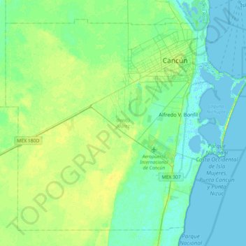
Nom : Carte topographique Benito Juárez, altitude, relief.
Lieu : Benito Juárez, Quintana Roo, Mexico (20.72845 -87.32335 21.23177 -86.74054)
Altitude moyenne : 7 m
Altitude minimum : -4 m
Altitude maximum : 21 m