
Carte topographique Johns Island
Carte interactive
Cliquez sur la carte pour afficher l’altitude.
À propos de cette carte
Nom : Carte topographique Johns Island, altitude, relief.
Altitude moyenne : 965 m
Altitude minimum : 693 m
Altitude maximum : 2 069 m
Autres cartes topographiques
Cliquez sur une carte pour visualiser sa topographie, son altitude et son relief.
Picket Hill
Canada > British Columbia > Regional District of Bulkley-Nechako > Area E (Ootsa Lake/François Lake)
Picket Hill, Area E (Ootsa Lake/François Lake), Regional District of Bulkley-Nechako, British Columbia, Canada
Altitude moyenne : 924 m
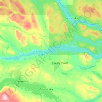
François Lake
Canada > British Columbia > Regional District of Bulkley-Nechako > Area E (Ootsa Lake/François Lake)
François Lake, Area E (Ootsa Lake/François Lake), Regional District of Bulkley-Nechako, British Columbia, Canada
Altitude moyenne : 984 m