Carte topographique Flieden
Cliquez sur la carte pour afficher l’altitude.
Flieden
Flieden is located in a valley north west of the Landrücken between the Vogelsberg and the Rhön. It is an area of low hills with the highest elevations being Knöschen near Buchenrod (509 m) and the Storker Küppel near Oberstork (470 m). At the very center of Flieden the creeks Magdloser Wasser und Kautzer Wasser merge into the river Fliede which later flows into the Fulda.
À propos de cette carte
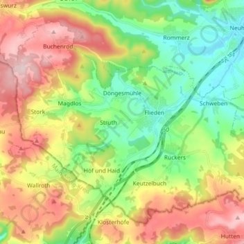
Nom : Carte topographique Flieden, altitude, relief.
Lieu : Flieden, Landkreis Fulda, Hesse, 36103, Germany (50.38125 9.48175 50.45737 9.62532)
Altitude moyenne : 376 m
Altitude minimum : 272 m
Altitude maximum : 521 m
Autres cartes topographiques
Cliquez sur une carte pour visualiser sa topographie, son altitude et son relief.

Milseburg
Germany > Hesse > Landkreis Fulda
The Milseburg is an extinct volcano and at 835 metres (2,740 ft) above sea level the second highest elevation in the Hessian part of the Rhön Mountains, Germany. The hill is located east of Fulda, near the villages of Kleinsassen and Danzwiesen. It is a popular destination for hikers and bikers.…
Altitude moyenne : 619 m