
Carte topographique Songkhla Province
Carte interactive
Cliquez sur la carte pour afficher l’altitude.
Songkhla Province
The province is on the Malay Peninsula, on the coast of the Gulf of Thailand. The highest elevation is Khao Mai Kaeo at 821 meters.
À propos de cette carte
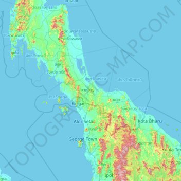
Nom : Carte topographique Songkhla Province, altitude, relief.
Lieu : Songkhla Province, Thailand (4.31902 97.98985 9.43902 103.10985)
Altitude moyenne : 78 m
Altitude minimum : -2 m
Altitude maximum : 1 991 m
Autres cartes topographiques
Cliquez sur une carte pour visualiser sa topographie, son altitude et son relief.